UPDATE: After press time, C-VILLE learned that VDOT removed the Eastern Bypass from its study recommendations on October 15. More info on This Just In.
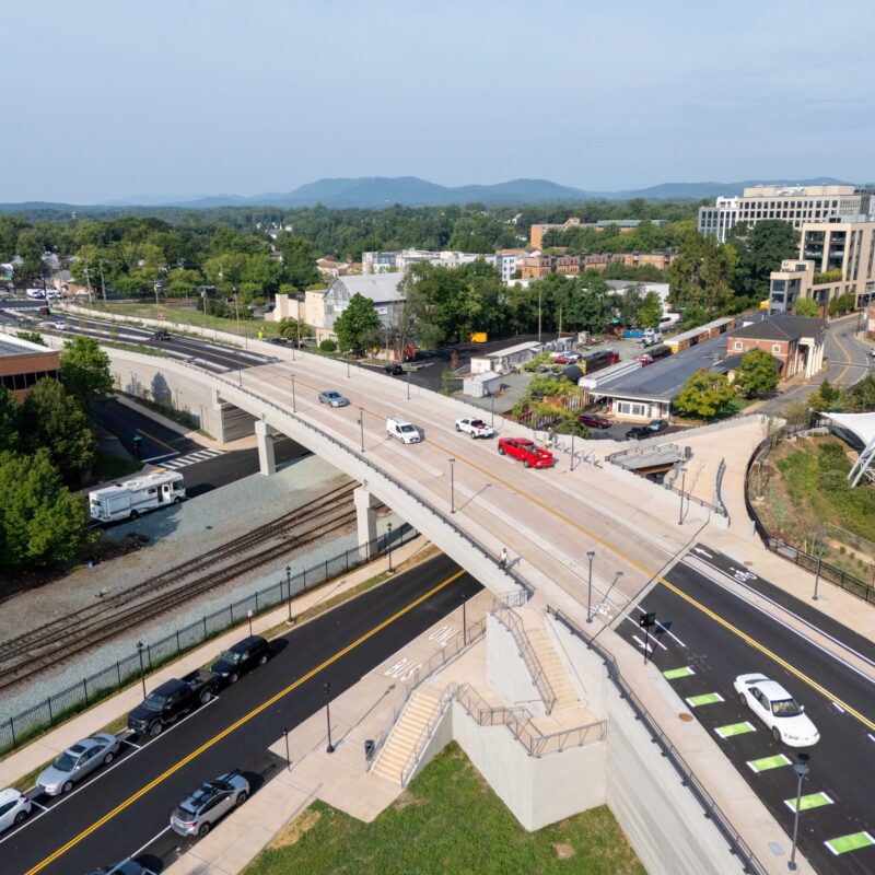
A line on a map, representing a road not likely to be built for decades, has nonetheless become a political hot potato in Albemarle. When VDOT presented a study of 219 miles of the U.S. 29 corridor last month, local officials and residents bristled at some of its recommendations—including the notion of a new road connecting Rte. 29 at Culpeper with I-64 in Keswick. The so-called Eastern Bypass would ideally take pressure off busy 29.
|
The so-called Eastern Bypass was one of the recommendations VDOT made when it presented a study of 219 miles of the U.S. 29 corridor last month. The new road would connect Rte. 29 at Culpeper with I-64 in Keswick and would personally impact Megan Weary, who with her husband Rob owns Keswick’s Roundabout Farm. “It would take out a major portion of land we till currently, and…land we’re looking at for expanding tillable acres,” she says. |

So far, though, the road has added more pressure than it’s relieved, in the form of public consternation and official pushback. Joseph Springer, a planner with Parsons Transportation (which administered the VDOT study), says he had received about 160 comments about the road as of October 13, the “vast majority” in opposition. Its route, as indicated on a VDOT map, would pass through two historic districts: Southwest Mountains and Keswick.
Megan Weary, who with her husband Rob owns Keswick’s Roundabout Farm, is among those who are dismayed by the prospect. In her case, it’s personal: The road, she says, would slash through her 65-acre farm, taking away up to 40 acres of land. “It would take out a major portion of land we till currently, and…land we’re looking at for expanding tillable acres,” she says, adding that six acres of federally listed wetlands would also be on the block if the road were built according to the current map.
So where did the idea come from? Springer says that, in the early part of the study process, a number of people suggested some sort of bypass east of 29—including Albemarle County Supervisor Dennis Rooker. But Rooker says that his suggestion was based on the premise that 29 itself needs to get faster. “I’m not proposing that an Eastern Bypass be built,” he says, “but if the state wants to have a Route 29 corridor from Charlottesville to Warrenton that approximates a limited access highway, that would be the only way from a practical standpoint they could achieve that….Whether or not that’s a goal that should be pursued is not for me to say.”
Responding to concerns about the proposed route, Springer emphasizes that the corridor as outlined in the study is conceptual, and that for such a road to actually be built, VDOT would go through a “20- or 30-year process” of securing funds and conducting studies. Even before those steps, he says, localities would have to establish the route as a planning corridor within their comprehensive plans. The VDOT study recommends that action, but if a resolution passed by the Board of Supervisors on October 7 is any indication, it would be a tough sell in Albemarle County.
The resolution doesn’t oppose a bypass outright, but the Supes recommend that the road generally follow Rte. 15, and connect to I-64 one exit further east, in Louisa County. Rooker points out that the City and County of Orange, plus Fluvanna and Louisa Counties, passed resolutions years ago requesting that Rte. 15 be upgraded to a four-lane road. ”It would seem logical that if those jurisdictions want a better road serving their area, [the state] could upgrade 15 which runs along relatively flat terrain compared to mountains,” Rooker says, adding that the land along such a route would likely be cheaper than in pricey Keswick. Springer says the route on the VDOT map, in order to be a “multimodal corridor,” was chosen to closely follow existing railroad tracks, which is why it diverges from Rte. 15 at Gordonsville and cuts into Albemarle. (The resolution also opposes many other recommendations in the study, including several proposed extensions of Leonard Sandridge Road.)
VDOT is slated to present its preliminary recommendations to the Commonwealth Transportation Board for a vote in early November. If approved, the blueprint would then guide planning along the 29 corridor.
Jeff Werner of the Piedmont Environmental Council called the road “unacceptable as a solution to congestion on Rte. 29” in his comments before the supervisors on October 7. His organization has objected to a lack of traffic modeling in VDOT’s study as well as to the fact that the route overlays a number of properties under conservation easement. Roundabout Farm is one of these.
“If it stays on the map,” Weary says, “then we will continue to spend a lot of time and effort trying to fight it. As far as the farming operation goes itself, we would have to think hard about putting any more money or time or energy into expanding or growing the infrastructure.”
Springer acknowledges that “most folks have been very concerned about potential impacts” but says VDOT must take a statewide view. “The further away [you are from the route] the more you see the benefits, and less of the disbenefits,” he says.
C-VILLE welcomes news tips from readers. Send them to news@c-ville.com.